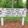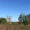
Land Manager: Ohio DNR - Hueston Woods State Park
 Germantown Metropark
15.3 mi 24.7 km • 1,120' Up 341.29 m Up • 1,120' Down 341.23 m Down


 Farmers…, OH
 Twin Valley Trail: Backpacking Route
26.8 mi 43.1 km • 1,635' Up 498.34 m Up • 1,623' Down 494.72 m Down


 Germantown, OH
 Miami Whitewater Forest Route
4.0 mi 6.4 km • 378' Up 115.34 m Up • 380' Down 115.93 m Down


 Harrison, OH
 North Riverside Natural Area Loop
2.0 mi 3.2 km • 30' Up 9.18 m Up • 31' Down 9.45 m Down


 Fairfield, OH
 Gilmore Ponds Loop
2.3 mi 3.6 km • 22' Up 6.6 m Up • 21' Down 6.44 m Down


 Fairfield, OH
 Sharon Woods Super Sampler
4.4 mi 7.1 km • 246' Up 75.09 m Up • 233' Down 70.9 m Down


 Sharonv…, OH


0 Comments