Trail Run Project Logo

A ridge crest trail with numerous spectacular views.


Your Rating: Rating Rating Rating Rating Rating      Clear Rating
Your Difficulty:
Your Favorites: Add To-Do · Your List
Zoom in to see details
Map Key

23.9

Miles

38.5

KM

90%

Runnable

3,776' 1,151 m

High

1,143' 348 m

Low

2,230' 680 m

Up

4,681' 1,427 m

Down

5%

Avg Grade (3°)

20%

Max Grade (11°)

Dogs Unknown

Features Birding · Commonly Backpacked · Fall Colors · Views · Wildlife

Requires a shuttle or 2 cars. Southern trailhead has limited parking spaces off of US Rt. 33.

Need to Know

Very limited water sources. One spring near the half-way mark (approx 12.4 miles from the southern terminus). Some backpackers stash water near the half-way point.

Take care to stay on the trail in the southern third of this run as it crosses private property.

Description

Recommend the Monongahela National Forest Hiking Guide book: wvbookco.com/ProductDetails…

More trail information may be found here--> hikingupward.com/MNF/NorthF…

Specific questions should be directed here: Cheat-Potomac Ranger District in Petersburg at (304) 257-4488

Flora & Fauna

Deer, turkey, bear, feral goats.

Contacts

Shared By:

Cole D

Trail Ratings

  4.6 from 12 votes

#713

Overall
  4.6 from 12 votes
5 Star
58%
4 Star
42%
3 Star
0%
2 Star
0%
1 Star
0%
Trail Rankings

#713

Overall
7 Views Last Month
3,262 Since Mar 6, 2019
Intermediate/Difficult Intermediate/Difficult

0%
0%
22%
44%
33%
0%

Photos

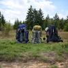
Dawn a few miles in from RT 33.
Jan 28, 2021 near Franklin, WV
Hike in early May 2020. Snow in the morning and t-shirt by afternoon!
Jan 28, 2021 near Petersburg, WV
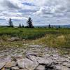
One of many beautiful views off of North Fork Mountain Trail, West Virginia.
May 29, 2019 near Petersburg, WV
loading

Weather


Current Trail Conditions

Unknown
Add Your Check-In

Check-Ins

none
Welcome

Join the Community! It's FREE

Already have an account? Login to close this notice.