Trail Run Project Logo

An easy summer day outing.


Your Rating: Rating Rating Rating Rating Rating      Clear Rating
Your Difficulty:
Your Favorites: Add To-Do · Your List
Zoom in to see details
Map Key

0.2

Miles

0.4

KM

72%

Runnable

2,366' 721 m

High

2,249' 685 m

Low

10' 3 m

Up

117' 36 m

Down

11%

Avg Grade (6°)

25%

Max Grade (14°)

Dogs Unknown

Features River/Creek · Swimming · Views · Waterfall

During summer months, law enforcement closes the trail at around 5 p.m. and directs everyone at the river to leave. Depending on the amount of snowpack during the prior season and the swiftness of the current, the trail and river may be off limits during the spring months when the current is fastest.

Need to Know

There is no restroom available. All trash and other items you take down, you are expected to take back up. There is one trash can placed by the Forest Service where the trail meets the river, but this is often full (depending on how many prior visitors there were).

If you decide to swim, take caution in and around the water. Swimmers have been lost here. If dangerous currents are in effect, then follow all Forest Service and local sheriff's office warnings and restrictions.

Runner Notes

Towards the end of the descent (and when ascending back from the river) the rock faces can become very slick, especially if there have been people swimming recently.

Description

The Stairs gets is name from the flight of stairs that descends from the parking lot off Highway 190 in the Tule River Canyon.

When you reach the parking lot, be prepared to climb down the stairs a couple hundred feet and follow the rest of the trail a little less than 0.25 miles to the river. Its not a very difficult run up or down if you're in relatively good shape, but exercise caution as some parts of the trail consist of crossing rock faces with no guardrails.

Flora & Fauna

Lots of small minnows in the water. Squirrels like to feed around the rocks and trees at the upper part of the trail.

Contacts

Shared By:

Chris Ince Jr.

Trail Ratings

  3.0 from 1 vote

#34413

Overall
  3.0 from 1 vote
5 Star
0%
4 Star
0%
3 Star
100%
2 Star
0%
1 Star
0%
Trail Rankings

#3,933

in California

#34,413

Overall
3 Views Last Month
74 Since Sep 16, 2018
Intermediate Intermediate

0%
0%
100%
0%
0%
0%

Photos

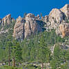
Looking up towards the rock on the east bank
Sep 16, 2018 near Strathmore, CA

0 Comments

Weather


Current Trail Conditions

Unknown
Add Your Check-In

Check-Ins

none
Welcome

Join the Community

Create your FREE account today!
Already have an account? Login to close this notice.

Get Started