
 Continue with onX Maps
 Continue with Facebook


 Particularly Special Place


 Intermediate
Intermediate
Intermediate
 Intermediate
Land Manager: Coopers Rock State Forest
 Coopers Rock Grand Loop
12.3 mi 19.7 km • 1,673' Up 510 m Up • 1,678' Down 511.53 m Down

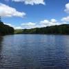
 Cheat Lake, WV
 Ragnar Relays WV Green Loop
3.6 mi 5.9 km • 311' Up 94.67 m Up • 306' Down 93.14 m Down
Ragnar Trail Appalachians - Yellow Loop
4.6 mi 7.4 km • 375' Up 114.42 m Up • 374' Down 113.97 m Down
Terra Alta, WV
 Fork Run Loop
8.0 mi 12.9 km • 951' Up 289.81 m Up • 951' Down 289.73 m Down
 Sugarloaf Sled Hill to Falls Overlook
4.6 mi 7.5 km • 78' Up 23.82 m Up • 1,267' Down 386.06 m Down
Ohiopyle, PA
 Laurel Highland 70.5mi Ultra Run
69.7 mi 112.2 km • 8,763' Up 2670.95 m Up • 8,624' Down 2628.72 m Down


0 Comments