
 Continue with onX Maps
 Continue with Facebook


 Particularly Special Place


 Intermediate

 Intermediate
Land Manager: Lakes Region Conservation Trust
 Rattlesnake
1.8 mi 2.8 km • 344' Up 104.84 m Up • 346' Down 105.33 m Down
 Holderness, NH
 Walter - Newton Loop
1.5 mi 2.5 km • 158' Up 48.3 m Up • 156' Down 47.69 m Down
Pine Mountain Loop
1.8 mi 2.9 km • 269' Up 82 m Up • 269' Down 81.88 m Down
 Welch-Dickey Mountain Loop
4.2 mi 6.8 km • 1,709' Up 520.84 m Up • 1,709' Down 520.85 m Down
Thornton, NH
Mount Osceola Out and Back
5.9 mi 9.4 km • 1,952' Up 595.09 m Up • 1,952' Down 595.07 m Down
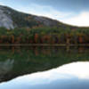
 Echo Lake Trail
0.9 mi 1.5 km • 94' Up 28.6 m Up • 94' Down 28.78 m Down
North C…, NH


0 Comments