Trail Run Project Logo

A trail that descends from Montezuma's Pass Overlook to the visitor center.


Your Rating: Rating Rating Rating Rating Rating      Clear Rating
Your Difficulty:
Your Favorites: Add To-Do · Your List
Zoom in to see details
Map Key

3.2

Miles

5.2

KM

76%

Runnable

6,706' 2,044 m

High

5,252' 1,601 m

Low

203' 62 m

Up

1,533' 467 m

Down

10%

Avg Grade (6°)

26%

Max Grade (14°)

Dogs No Dogs

Features Views

Coronado National Memorial is open year-round from civil twilight dawn to civil twilight dusk (approximately 1/2 hour before sunrise to 1/2 hour after sunset). The park closes each night and visitors are expected to be back from runs and activities 1/2 hour after sunset.

Description

The Joe's Canyon Trail provides sweeping views of the grasslands in Arizona and Mexico and the surrounding mountains. The trail can be accessed by parking at the visitor center and climbing up to Montezuma Pass. However, a much easier option would be to drive up to or take the shuttle to Montezuma Pass and run down to the visitor center.

From Montezuma Pass, run to the top of the parking lot and follow the trail as it leads toward Coronado Peak. The Joe's Canyon Trail breaks off to the left and follows a singletrack dirt trail that hugs the hillside in the shade of Coronado Peak. At roughly 0.4 miles, the trail begins to drop down the ridge line to where it comes to the junction with the Yaqui Ridge Trail at 0.8 miles.

From here, the views of the San Pedro River Valley stretch out before you. You can see the Huachuca Mountains in the Coronado National Forest. Looking into Mexico, you can see the grass plains and mountains in the distance that are common to Sonora, Mexico. Continuing straight ahead, the trail levels out until about the 1.5-mile mark, when the trail begins to drop more steeply along the hillside.

Using several sets of switchbacks, the trail begins its 1000 foot descent over the last mile of the trail. The trail crosses several washes during the descent, and you can enjoy the views of the hills as they begin to rise above you. At the end of the trail, you arrive at the Montezuma Canyon Road. If take a right at the road, you'll arrive at the visitor center in roughly 500 feet. If you parked your car at Montezuma Pass, you can either try to catch a ride back to the top, or turn around and climb back up the hillside you just descended to your car.

This trail is exposed to the sun, so make sure to bring plenty of water, wear sunscreen, and wear a hat to help cope with the sun. It's best to run in the cool of the day when temperatures are less extreme.

Flora & Fauna

Cacti, cholla, agave, and other desert plants line the trail.

Contacts

Land Manager: City of Sierra Vista, AZ

Shared By:

David Hitchcock

Trail Ratings

  3.3 from 3 votes

#26759

Overall
  3.3 from 3 votes
5 Star
0%
4 Star
33%
3 Star
67%
2 Star
0%
1 Star
0%
Trail Rankings

#886

in Arizona

#26,759

Overall
4 Views Last Month
508 Since Jan 7, 2018
Intermediate Intermediate

0%
33%
67%
0%
0%
0%

Photos

The moon rises above Arizona from the trail in the late afternoon.  You can see the 16 foot border wall stretching into the distance from the peak.
Jan 7, 2018 near Sierra…, AZ
Sunbeams looking south into Mexico.
Nov 2, 2016 near Sierra…, AZ
As West Montezuma Canyon Road crosses the ridge, you can see the parking lot at gap where the road crosses.   There are mountains everywhere you look!
Jan 7, 2018 near Sierra…, AZ
While the trail is narrow, it is easy traveling.  And depending on the time of day, you might get some shade from Coronado Peak.
Jan 7, 2018 near Sierra…, AZ
The Coronado Peak Trail climbs the hill using switchbacks and stairs.
Jan 7, 2018 near Sierra…, AZ
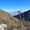
Joe's Canyon Trail runs along the ridge here before dropping down to the visitor center.  Sweeping views await.
Jan 7, 2018 near Sierra…, AZ

0 Comments

Weather


Current Trail Conditions

Unknown
Add Your Check-In

Check-Ins

none

Join the Community

Create your FREE account today!
Already have an account? Login to close this notice.

Get Started.