
 Continue with onX Maps
 Continue with Facebook


 Particularly Special Place


 Intermediate
Intermediate
Intermediate
 Intermediate
Land Manager: NPS - Organ Pipe Cactus National Monument
 Bull Pasture/ Estes Canyon Loop Trail
3.6 mi 5.8 km • 925' Up 281.98 m Up • 925' Down 281.86 m Down
 Ajo, AZ
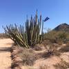
Organ Pipe Cactus and Mines Loop Trail
Ajo, AZ
Organ Pipe Cactus and Mines Loop Trail
10.4 mi 16.8 km • 575' Up 175.3 m Up • 575' Down 175.19 m Down
 Cowpie Rock Loop
5.7 mi 9.2 km • 348' Up 106.18 m Up • 350' Down 106.61 m Down


0 Comments