
 Continue with onX Maps
 Continue with Facebook


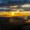
 Particularly Special Place


 Intermediate
Intermediate
Intermediate
 Intermediate
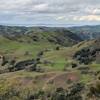
 Elderberry - Rocky View - Cuestas Loop
8.1 mi 13.1 km • 1,397' Up 425.89 m Up • 1,396' Down 425.64 m Down

 Danville, CA
 Mount Diablo Summit Loop - North
13.7 mi 22.1 km • 3,378' Up 1029.66 m Up • 3,369' Down 1026.85 m Down
Brazen Racing Diablo Trails Challenge 50k
31.4 mi 50.5 km • 6,147' Up 1873.48 m Up • 6,148' Down 1873.76 m Down
Saranap, CA
 Ohlone-Crystyl Ranch Loop
5.5 mi 8.9 km • 734' Up 223.87 m Up • 747' Down 227.67 m Down
EBRPD Trails Challenge 2017: Anthony Chabot
8.5 mi 13.6 km • 1,085' Up 330.68 m Up • 1,093' Down 333.08 m Down
Ashland, CA
Sunol: Flag Hill - High Valley - Little Yosemite
8.5 mi 13.7 km • 1,952' Up 595.06 m Up • 1,950' Down 594.3 m Down
East Fo…, CA


0 Comments