Dogs Unknown


This whole system is primarily used by mountain bikes but is open to foot traffic. Please stay alert while on the trails and be respectful of other users.
Description
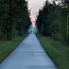
This section of the outer loop skirts the south side of the Udell Hills with a heck of a climb to the top. Regardless of the direction you're running, this climb will get your heart pounding. The descent off either side provides the reward for all the hard work you did to get to the top. You can hop into the Big M trails at the top and enjoy the old school,
Catamount Trail and follow your bliss from there.
Bullwacker Trail undulates along the south side of the Udell Hills so it's the first to open up when the snow melts. It's a bench cut singletrack path with some punchy, high wattage efforts but don't worry, it will provide reprieve with some longer twisty and tight ribbons where gravity provides the energy for you.
Contacts
Shared By:
andy amstutz

 Continue with onX Maps
 Continue with Facebook


 Particularly Special Place


 Intermediate/Difficult


 Veterans Memorial 150


0 Comments