Land Manager: USFS - Ouachita National Forest Office
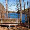
 LOViT: Ode to Bench
4.6 mi 7.3 km • 307' Up 93.54 m Up • 307' Down 93.54 m Down


 Mount Ida, AR
 Lake Ouachita Vista Trail (LOViT)
38.3 mi 61.6 km • 3,929' Up 1197.42 m Up • 4,032' Down 1228.94 m Down


 Mount Ida, AR
 Sunset Loop
9.3 mi 14.9 km • 1,155' Up 351.97 m Up • 1,581' Down 481.9 m Down


 Hot Spr…, AR
 Hot Springs Mountain Loop
1.7 mi 2.7 km • 205' Up 62.62 m Up • 199' Down 60.62 m Down


 Hot Spr…, AR
 Arkansas Traveller 100
103.9 mi 167.2 km • 7,734' Up 2357.27 m Up • 7,719' Down 2352.6 m Down


 Perryville, AR
 Ouachita National Recreation Trail
225.9 mi 363.5 km • 25,674' Up 7825.35 m Up • 25,473' Down 7764.3 m Down


 Talihina, OK


0 Comments