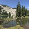
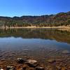
The Upper Abbotts Lake Trail is a singletrack dirt and gravel path that climbs up toward Hell Hole Ridge. The trail is sometimes called the Big Meadows Trail, which it connects with partway up the trail.
We use cookies to improve your browsing experience, to show you
personalized content, and for statistical purposes. By continuing
to navigate our website, you accept our use of cookies. Read our
Privacy Policy to learn more.

 Continue with onX Maps
 Continue with Facebook


 Particularly Special Place


 Difficult


0 Comments