Trail Run Project Logo

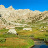
An off-trail route with extraordinary panoramas, beautiful lakes, and may be the remotest, desirable run in the Sierras.


Your Rating: Rating Rating Rating Rating Rating      Clear Rating
Your Difficulty:
Your Favorites: Add To-Do · Your List
Zoom in to see details
Map Key

2.8

Miles

4.6

KM

89%

Runnable

11,109' 3,386 m

High

10,663' 3,250 m

Low

695' 212 m

Up

258' 79 m

Down

6%

Avg Grade (4°)

51%

Max Grade (27°)

Dogs No Dogs

Features Lake · Swimming · Views

There is currently no evidence that anyone has ever been to this plateau. Let's keep it that way. Wilderness permits are required. There are daily quotas. Reservations fill early but 1/4th of the permits are first-come first-serve the day before you start.

Description

This route is entirely off-trail, but requires no rock climbing skills, It requires good route-finding skills. Via the right route, there are no dangerous exposures. The Red Spur Lakes Plateau is entirely surrounded by the Red Spur and Kern and Colby Canyons. The described route is the only reasonable way in without rock climbing skills. It is rarely visited and probably has spots where no one has walked before. The plateau is covered with talus, but the route avoids most of it.

Coming from the gap above Picket Creek, once you cross Kaweah Basin Creek, find an easy way to wander southeast while slowly climbing towards the northern end of the Red Spur. From a point at about 10,800 feet and slightly past the large lake below, look for a rocky chute with some trees. Climb up about 250 feet in elevation to the top of the ridge at the end of the spur. There you'll find an extraordinary 180° panorama of the entire Kaweah and Picket Creek basins and the Colby Pass area.

Continue descending the ridge to the north until you find a good way to reach the small lake below. From the southeast end of the lake, run up the draw to the first large lake, which is much more beautiful and has great views across to Kern Point and the Sierra crest.

Continue southeast up a low ridge that passes between two small lakes. At the top, angle down to the east shore of another large beautiful lake with great views of the Red Spur. Somewhat before the far end of the lake, climb up the crest of the low ridge headed southeast. The top of this ridge provides a sweeping panorama of the main ridge of the Sierras from Junction Peak to well past Mt. Whitney, including several 14,000 ft peaks.

I call the area to the south the "Talus Wasteland". If you run down to the west a little ways, you have a view of what I call "Talus Lakes". About 15 years ago, my son and I reached this point by climbing from the Chagoopa Plateau over the southern end of the Red Spur. Once on top of the Red Spur, we made our way along the crest until we came to a ridge that brought us down to the plateau. We then run north across the talus. This is a shorter way in and you can make a loop by coming in over the Red Spur and going out via the Kaweah Basin, but you'll get very tired of talus.

You can also run to the point at the north end of the plateau, directly above Junction Meadow, or from the northernmost large lake, you could run up the ridge to the southwest to reach the highest lakes on the plateau.

Flora & Fauna

I saw no animal larger than a marmot on the plateau. It's almost all foxtail pines that remarkably seem to grow straight out of the granite.

Contacts

Shared By:

Lee Watts

Trail Ratings

  4.5 from 2 votes

#3

in Kaweah Basin

#9332

Overall
  4.5 from 2 votes
5 Star
50%
4 Star
50%
3 Star
0%
2 Star
0%
1 Star
0%
Trail Rankings

#3

in Kaweah Basin

#851

in California

#9,332

Overall
2 Views Last Month
432 Since Apr 27, 2017
Difficult Difficult

0%
0%
0%
0%
100%
0%

Photos

Kern-Kaweah Canyon looking towards Colby Pass, Table Mt. and Kern Point taken from the north end of the Red Spur.
Apr 27, 2017 near Lone Pine, CA
Foxtail pine rise from the granite along Red Spur Lakes Plateau. This view is looking toward Kern Peak, Kern Canyon, and the Sierra Crest.
Apr 27, 2017 near Lone Pine, CA
This is my favorite of the Red Spur Lakes.
Apr 27, 2017 near Lone Pine, CA
This is a view of the first large Red Spur Lake, looking toward the Kern Point and Mt. Tyndell portion of the Sierra Crest.
Apr 27, 2017 near Lone Pine, CA
This is Kaweah Basin as seen from the north end of Red Spur Lakes Plateau. Picket Creek Basin can be seen on the extreme right.
Apr 27, 2017 near Lone Pine, CA
From Red Spur Lakes Plateau, this is looking up Whitney Creek in the right center and Wallace Creek in the left center.
Apr 27, 2017 near Lone Pine, CA

0 Comments

Weather


Current Trail Conditions

Unknown
Add Your Check-In

Check-Ins

none
Welcome

Join the Community

Create your FREE account today!
Already have an account? Login to close this notice.

Get Started