
 Continue with onX Maps
 Sign in with Facebook


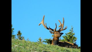
 Particularly Special Place


 Intermediate/Difficult
Intermediate/Difficult
Intermediate/Difficult
 Intermediate/Difficult
Land Manager: National Park Service - Rocky Mountain National Park
 Mummy Kill Route (Mummy Marathon)
17.4 mi 28.0 km • 4,920' Up 1499.48 m Up • 7,488' Down 2282.32 m Down
 Estes Park, CO
 Mirror Lake Out and Back
13.4 mi 21.5 km • 2,078' Up 633.3 m Up • 2,076' Down 632.82 m Down
 Lulu City Out-and-Back
3.5 mi 5.7 km • 493' Up 150.25 m Up • 257' Down 78.22 m Down
 Baker Gulch to Bowen Lake
19.9 mi 32.0 km • 4,483' Up 1366.38 m Up • 4,483' Down 1366.29 m Down
Grand Lake, CO
Bear Lake TH to Fern Lake TH
8.5 mi 13.6 km • 1,180' Up 359.71 m Up • 2,524' Down 769.27 m Down
Estes Park, CO
Crags Campground to American Lakes
6.5 mi 10.4 km • 1,348' Up 410.76 m Up • 1,347' Down 410.53 m Down


0 Comments