
 Continue with onX Maps
 Continue with Facebook


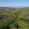
 Particularly Special Place


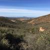
 Intermediate
Intermediate
Intermediate
 Intermediate
Land Manager: City of San Diego - Parks & Recreation
 Lusardi Creek Loop Trail
10.3 mi 16.6 km • 983' Up 299.67 m Up • 968' Down 295.05 m Down

 Slab Loop
4.3 mi 6.9 km • 713' Up 217.29 m Up • 714' Down 217.64 m Down
 Los Peñasquitos Creek Waterfall
3.7 mi 6.0 km • 68' Up 20.72 m Up • 68' Down 20.76 m Down
Iron Mountain Peak Trail #10
5.8 mi 9.4 km • 1,067' Up 325.19 m Up • 1,067' Down 325.1 m Down
Poway, CA
 Torrey Pines State Reserve Loop
2.4 mi 3.9 km • 329' Up 100.18 m Up • 330' Down 100.46 m Down
Del Mar, CA
Batiquitos Lagoon Trail
3.3 mi 5.3 km • 39' Up 11.99 m Up • 39' Down 12 m Down


0 Comments