Trail Run Project Logo

This trail follows the Gunnison River and allows you to see what it is like at the bottom of the canyon along the river.


Your Rating: Rating Rating Rating Rating Rating      Clear Rating
Your Difficulty:
Your Favorites: Add To-Do · Your List
Zoom in to see details
Map Key

0.7

Miles

1.2

KM

91%

Runnable

6,824' 2,080 m

High

6,757' 2,059 m

Low

95' 29 m

Up

70' 21 m

Down

4%

Avg Grade (2°)

15%

Max Grade (8°)

Dogs Leashed

Features Fishing · River/Creek · Views

Need to Know

Releases from Morrow Point Dam can cause strong currents and fluctuating water levels which could impact the length of the trail as it approaches the river. When you arrive, check to see if the spillways are open. If they are open, be cautious near the river as it may be moving swifter than normal.

Description

The Mesa Creek Trail provides you the opportunity to experience what it is like to be at the bottom of the Black Canyon along the Gunnison River without having to descend from the rim. To access the trailhead, take the Cimarron entrance off Highway 50 and follow the road past the campground to the parking lot at the Morrow Point Dam.

From the parking lot at the dam, the trail drops down to the river via a gravel trail. The trail crosses over the Crystal River Reservoir and then follows the far side of the trail along a narrow, singletrack trail that alternates between rock and dirt. The trail rolls along the riverside for roughly 3/4 of a mile. Part way along the trail, there is a side trail that leads to a small waterfall. After enjoying the small waterfall, the trail continues until it drops to the riverside.

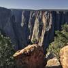
As you run along the trail, look at the steep canyon walls surrounding you. This gives you an opportunity to see what it is like to be along the river in the Black Canyon of the Gunnison National Park, which is rather down the river. There are several places along the trail where you can get in the water without being in the current, which can be fast at times. When you reach the end of the trail, take a moment to enjoy the scenery before turning around and making your way back to the parking area.

On the way back, you can take a small trail that leads closer to the Morrow Point Dam, which gives you a better idea for just how tall the dam is.

Shared By:

Trail Run Project Staff with improvements by David Hitchcock

Trail Ratings

  4.0 from 4 votes

#11922

Overall
  4.0 from 4 votes
5 Star
0%
4 Star
100%
3 Star
0%
2 Star
0%
1 Star
0%
Trail Rankings

#1,066

in Colorado

#11,922

Overall
4 Views Last Month
495 Since Feb 19, 2016
Intermediate Intermediate

0%
40%
60%
0%
0%
0%

Photos

Looking Downstream
Aug 3, 2019 near Montrose, CO
Morrow Point Dam
Aug 3, 2019 near Montrose, CO
Mesa Creek Trail.
Feb 19, 2016 near Montrose, CO
The trial ends at the riverside where you can enjoy putting your feet in the water and enjoying a break from the heat.
Jul 11, 2021 near Montrose, CO
From the end of the trail, looking back at the Morrow Point Dam.
Jul 11, 2021 near Montrose, CO
As the trail follows the river, if you look up, you can get an idea how steep the canyon walls are in the area.  This gives you an idea of how steep the walls are in Black Canyon of the Gunnison.
Jul 11, 2021 near Montrose, CO

0 Comments

Weather


Current Trail Conditions

Unknown
Add Your Check-In

Check-Ins

none
Welcome

Join the Community

Create your FREE account today!
Already have an account? Login to close this notice.

Get Started