Trail Run Project Logo

A 50km up and down trail on one of the iconic mountains of South Africa.


Your Rating: Rating Rating Rating Rating Rating      Clear Rating
Your Difficulty:
Your Favorites: Add To-Do · Your List
Zoom in to see details
Map Key

31.4

Miles

50.5

KM

80%

Runnable

10,138' 3,090 m

High

4,596' 1,401 m

Low

7,666' 2,337 m

Up

7,664' 2,336 m

Down

9%

Avg Grade (5°)

77%

Max Grade (38°)

Dogs No Dogs

Features Birding

Overview

This prestigious 50km trail run takes place in the Royal Natal Park, part of the Ukhahlamba-Drakensberg World Heritage Site and home to the endangered Bearded Vulture. The Bearded Vulture once roamed freely from the Cape of Good Hope, along the eastern mountain spine of Africa, and into northwest Africa. Now it is thought that the only population left in the Southern Hemisphere resides in our isolated and rugged Maluti-Drakensberg highlands, and that there are less than 100 pairs left.

Make no mistake, the Old Mutual Sunday Tribune Mont-Aux-Sources Challenge is a toughie, but its definitely worth the blood, sweat and tears, and will certainly be an experience of a lifetime. Expect to run through some of our countrys most rugged and beautiful scenery. Your route will take you through the Mahai Valley and up towards the escarpment where you'll have to tackle the chain ladders and then scramble down the Gully. This race is a spectacular adventure, and worth every ache you'll suffer afterwards!

Need to Know

Be prepared for climbing two sets of chain ladders at 23km and a very challenging descent via the gully at 27km.

Description

The route follows a hiking path up the Mahai Valley, past the Mahai Falls, to Witsieshoek Mountain Resort a climb of some 700m over a distance of 9km and the first of four refreshment points. From here to the Sentinel Car Park, a distance of 9km, its very rough undulating dirt road resulting in a further climb of some 300m, with fantastic views all around on a clear day. Water must be carried from the Sentinel Car Park to the top and back. Assume that the Tugela River is not flowing well enough to provide water on the summit.

A concrete path is followed for a short distance, ending at the start of a zigzag hiking path past the Witches, the Sentinel, Western Buttress and Sentinel Caves to the chain ladders, a further climb of 450m. The altitude will be affecting you by this stage, especially those runners who live and train at sea level.

At the chain ladders, everyone is required to wear a safety belt and sliding device attached to fixed ropes alongside the ladders. Peak High Mountaineering helpers will assist you in getting attached and detached to the fixed safety lines. The trick is to not look down, but to concentrate on moving one hand at a time up the two ladders. Youll reach the top in no time, and then its a short scramble over rocky terrain, a skip over the Tugela River and a much-appreciated run down a gentle slope to the Tugela Falls.

Now the hard part begins! Laboring up to the Sentinel Gully. There is a risk of loose rocks and stones being dislodged. Make use of the fixed ropes as far as possible; they will give you stability and guide you away from the loose sections. You cannot run down the Gully. Just proceed carefully and cautiously, and youll reach the bottom soon enough.

You'll now be back on the path that led to the chain ladders. Follow the same route back to the Sentinel Car Park, Witsieshoek and the Finish, utilizing the refreshment points along the dirt road.

Flora & Fauna

High altitude bird species of Southern Africa in attendance. Look out for Drakensberg Rockjumper, Draensberg Siskin, Gurney's Sugarbird and the majestic Bearded Vulture.

History & Background

You cross the start of the mighty Tugela at the top of the mountain as you turn to head out. At the start, where the Tugela tips over the lip of the mountain, you'll find the second highest waterfall in the world.

Shared By:

Hanno Langenhoven

Trail Ratings

  5.0 from 2 votes

#1318

Overall
  5.0 from 2 votes
5 Star
100%
4 Star
0%
3 Star
0%
2 Star
0%
1 Star
0%
Recommended Route Rankings

#1

in South Africa

#1,318

Overall
41 Views Last Month
3,715 Since Feb 16, 2016
Difficult Difficult

0%
0%
0%
0%
100%
0%

Photos

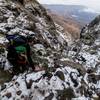
And finally down the mountain you go.
Feb 19, 2016 near Phuthad…, ZA
Running past one of the many caves in the area.
Feb 19, 2016 near Phuthad…, ZA
Top end of the gully and down you go.
Feb 19, 2016 near Phuthad…, ZA
Just had a snack at Witsieshoek and the climbing starts getting serious.
Feb 19, 2016 near Phuthad…, ZA
Up the ladders you go!
Feb 19, 2016 near Phuthad…, ZA
Running on the lower slopes of the trail.
Feb 19, 2016 near Phuthad…, ZA

0 Comments

Current Trail Conditions

Unknown
Add Your Check-In

Check-Ins

Sep 10, 2016
Hanno Langenhoven
A stunning, windy, rainy, typical high mountain run. Enjoyed every moment as always an epic experience. South Africa's iconic mountain trail run.
Welcome

Join the Community

Create your FREE account today!
Already have an account? Login to close this notice.

Get Started