Trail Run Project Logo

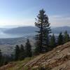
This is part of phase 1 of the Watershed Crest Trail with stunning views of Lake Pend Oreille.


Your Rating:      Clear Rating
Your Difficulty:
Your Favorites: Add To-Do · Your List
Zoom in to see details
Map Key

3.1

Miles

4.9

KM

83%

Runnable

6,104' 1,861 m

High

4,789' 1,460 m

Low

1,318' 402 m

Up

3' 1 m

Down

8%

Avg Grade (5°)

23%

Max Grade (13°)

Dogs Off-leash

Features Birding · Fall Colors · Lake · Views · Wildflowers · Wildlife

None unless mud is an issue during spring breakup or the snow is too deep.

Runner Notes

This trail has been built and maintained by mountain bikers but hikers and runners are welcome. It's is 100% runnable either direction and the huge banked corners are really a blast on the way down.

Description

This trail starts from a gravel road just above Sidewinder and makes its way through beautiful alpine forests and breaks out onto stunning beargrass and huckleberry meadows. The pitch is nice and steady but unrelenting. Benches have been placed at some of the viewpoints in case you need a break. The tread is smooth, which makes travel along the way relaxed and pleasant. The views of Lake Pend Oreille and the Pend Oreille River are absolutely gorgeous!

Flora & Fauna

Wildflowers in spring/summer, deer, elk moose and bears inhabit this area.

Contacts

Shared By:

Jim Mellen

Trail Ratings

  5.0 from 1 vote

#2645

Overall
  5.0 from 1 vote
5 Star
100%
4 Star
0%
3 Star
0%
2 Star
0%
1 Star
0%
Trail Rankings

#93

in Idaho

#2,645

Overall
4 Views Last Month
913 Since Oct 31, 2015
Difficult

0%
0%
0%
0%
100%
0%

Photos

The top of Sidewinder
Nov 6, 2015 near Ponderay, ID
A snowy Sunday jaunt on the Highpoint trail.
Nov 9, 2015 near Ponderay, ID
Dave Reseska builds trail on a work day
Oct 31, 2015 near Ponderay, ID

0 Comments

Weather


Current Trail Conditions

Unknown
Add Your Check-In

Check-Ins

none