Dogs Unknown

Features
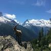
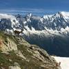
Views
Overview
This run of intermediate difficulty has a little of everything. Beginning with the pastoral charm of Vallorcine, followed by a huge climb up to the Refuge de la Loriaz alpine hut, a steep descent to the forest, a river crossing (via bridge), and finally a waterfall with a relaxing restaurant.
Need to Know
If you stay in the Chamonix Valley your accommodation provider should provide you with a Guest Card good for free train travel. This trail begins at a train station.
Description
Begin at the parking lot to the right of the main road leading to Vallorcine. This a large parking lot with a train stop. Head north on the road, take a right and cross the train tracks to connect to
Chemin des Diligences.
Follow the path with the train tracks to your left the entire way. The path ends as you approach a paved road and houses. Turn left cross the train tracks again and then cross the bridge over the river. Turn right at the main road and head down it a short distance until you take your first left. Head up this road (D210) a short distance and take your first left. This road will take you up to a farm house.
The
Chemin Rural dit de la Villaz path begins directly behind the farm house. After a short distance take the trail on your left into the forest. This short connector trail will connect you to the
Les Rupes to Refuge de la Loriaz Dirt Road trail. Turn left at the intersection.
Before long the trail will begin a long series of steep switchbacks. Eventually, the switchbacks will end and the trail will straighten somewhat. At the next intersection, stay left and begin the second series of switchbacks as treeline ends. The trail will end at the intersection with the
Refuge de la Loriaz South trail near the Refuge de la Loriaz dirt access road.
At this point, you can either turn left and head back down or you can continue up to the Refuge de la Loriaz. Continue up the trail and cross the dirt access road. There is a small footpath here which will loop up around the alpine hut. Do the loop and continue back down this path to the
Refuge de la Loriaz South trail.
Descend steeply on this rocky singletrack. Stay right at the first intersection (left is the
Les Rupes to Refuge de la Loriaz Dirt Road trail). After many switchbacks, the trail will T, turn right here. The trail will now straighten out and descend to the Nant de Loriaz stream with a bridge crossing. Continue on to the Refuge de la Loriaz dirt access road.
Head down the access road to the next switchback and continue straight onto the
Sur-le-Rocher trail. Head southwest between a gathering of houses. At the end of the houses, this trail will drop down the hillside (another continues along the contour of the hillside). Follow the trail through a wooded area until you reach a couple of farm houses at
Sur-le-Rocher. Turn right and follow the trail down to the river and the bridge crossing.
Continue along the river a short ways over many boulders until you come to the waterfall and restaurant. From here jump on the
Cascade de Berard Access Road and follow it back to the main road. Turn left at the main road and you'll soon reach the parking lot where you started.
Shared By:
Tad Davis

 Continue with onX Maps
 Continue with Facebook


 Particularly Special Place


 Difficult


0 Comments