Continue with onX Maps
 Sign in with Facebook


 Particularly Special Place


Umatilla National Forest
 WA
WA- Southeast Washington
- Umatilla National Forest


Recommended Routes in Umatilla National Forest - 2
Trail Run Project is built by runners like you. Add Your Recommended Routes


Umatilla National Forest Running
- 289 Miles 465 Kilometers of Trail
- 2 Recommended Routes
- 11
Easy Trails

- 19
Intermediate Trails

- 32
Difficult Trails

Trail Run Project is built by runners like you. Share
what you know about this area!
Areas Within Umatilla National Forest
Weather Averages
|
High
|
Low
|
Precip
|
Days w/
|
| J | F | M | A | M | J | J | A | S | O | N | D |
Trails in Umatilla National Forest - 60
Trail Run Project is built by runners like you. Add Your Trails
7.7
mi
12.4
km
#1Bear Creek Trail
 Difficult
Pomeroy, WA

|
Difficult
|
Pomeroy, WA |
1
|
|
|
9.7
mi
15.6
km
#2Sawtooth Trail #3256
Difficult
Walla Walla East, WA

|
Difficult
|
Walla Walla East, WA |
2
|
|
|
16.4
mi
26.3
km
#3Mt. Misery Trail #3113
Difficult
Dayton, WA
|
Difficult
|
Dayton, WA |
3
|
|
3.0
mi
4.9
km
#4Touchet Corral Trail #3243
 Intermediate/Difficult
Dayton, WA
|
Intermediate/Difficult
|
Dayton, WA |
2
|
|
|
8.0
mi
12.8
km
#5Grizzly Bear Trail #3103
Difficult
Walla Walla East, WA
|
Difficult
|
Walla Walla East, WA |
1
|
|
2.8
mi
4.4
km
#6Wildcat/Cavalier Spring Trail #3245
 Intermediate
Walla Walla East, WA
|
Intermediate
|
Walla Walla East, WA |
1
|
|
|
5.8
mi
9.4
km
#7Rattlesnake Trail
Intermediate/Difficult
Dayton, WA
|
Intermediate/Difficult
|
Dayton, WA |
1
|
|
|
6.1
mi
9.9
km
#8Middle Point Ridge Trail #3116
Difficult
Dayton, WA
|
Difficult
|
Dayton, WA |
3
|
|
|
3.9
mi
6.2
km
#9Turkey Creek Trail #3136
Difficult
Dayton, WA
|
Difficult
|
Dayton, WA |
2
|
|
|
4.5
mi
7.2
km
#10Panjab Trail #3127
Difficult
Dayton, WA
|
Difficult
|
Dayton, WA |
1
|
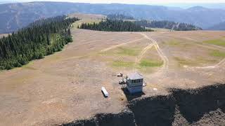
Photos of Umatilla National Forest - 30
Trail Run Project is built by runners like you. Add Your Photos