
 Continue with onX Maps
 Continue with Facebook


 Particularly Special Place


 Intermediate/Difficult

 Intermediate/Difficult
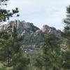
 Black Elk Peak Loop
7.9 mi 12.7 km • 1,357' Up 413.68 m Up • 1,357' Down 413.67 m Down
 Custer, SD
 Horsethief Lake Loop
11.1 mi 17.9 km • 1,672' Up 509.77 m Up • 1,672' Down 509.72 m Down
Custer, SD
Black Elk Peak Loop
15.7 mi 25.3 km • 3,476' Up 1059.4 m Up • 3,527' Down 1074.92 m Down
Custer, SD
 Lookout Point Loop
4.9 mi 7.8 km • 429' Up 130.91 m Up • 428' Down 130.56 m Down
Boland Ridge Trail
5.3 mi 8.6 km • 632' Up 192.52 m Up • 632' Down 192.61 m Down
Far East / Founders Valley Loop
2.9 mi 4.7 km • 327' Up 99.58 m Up • 327' Down 99.79 m Down
Rapid City, SD


0 Comments