
 Continue with onX Maps
 Continue with Facebook


 Particularly Special Place


 Very Difficult
Very Difficult
Very Difficult
 Very Difficult
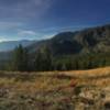
Land Manager: Salmon-Challis National Forest
 Devil of a Drop
14.2 mi 22.9 km • 808' Up 246.29 m Up • 6,110' Down 1862.34 m Down
 Joseph, OR
 Granite Mountain Lookout
5.6 mi 9.0 km • 1,732' Up 527.84 m Up • 1,732' Down 527.8 m Down
 McCall, ID
Legend of Bear Pete 30k
McCall, ID
Legend of Bear Pete 30k
18.2 mi 29.3 km • 3,324' Up 1013.01 m Up • 3,327' Down 1013.94 m Down
McCall, ID
Goose Creek Falls
3.1 mi 5.0 km • 759' Up 231.47 m Up • 759' Down 231.39 m Down
McCall, ID
Crestline Trail (#109)
15.6 mi 25.1 km • 2,745' Up 836.69 m Up • 4,381' Down 1335.45 m Down


0 Comments