
 Continue with onX Maps
 Continue with Facebook


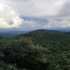
 Particularly Special Place


 Intermediate

 Intermediate
Land Manager: Berkshire Natural Resources Council
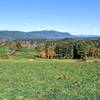
 Sunset Rock
3.8 mi 6.1 km • 1,052' Up 320.51 m Up • 1,051' Down 320.32 m Down
Bear Mountain
5.4 mi 8.7 km • 1,549' Up 472.12 m Up • 1,548' Down 471.96 m Down
 Salisbury, CT
CT State Highpoint/Tri-point Out and Back
Salisbury, CT
CT State Highpoint/Tri-point Out and Back
2.9 mi 4.7 km • 1,045' Up 318.64 m Up • 1,045' Down 318.48 m Down
 Ledges/Overbrook Loop
2.7 mi 4.3 km • 894' Up 272.42 m Up • 898' Down 273.68 m Down
Brace Mountain Out-and-Back
3.9 mi 6.3 km • 1,445' Up 440.51 m Up • 1,445' Down 440.56 m Down
Rand's View Out and Back
5.4 mi 8.7 km • 1,110' Up 338.19 m Up • 1,107' Down 337.29 m Down
Canaan, CT


0 Comments