
 Continue with onX Maps
 Continue with Facebook


 Particularly Special Place


 Intermediate

 Intermediate
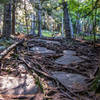
 Robert Frost Trail
40.2 mi 64.7 km • 5,360' Up 1633.58 m Up • 5,892' Down 1795.84 m Down
Wendell, MA
Northfield Mountain Trails
11.3 mi 18.3 km • 1,913' Up 583.11 m Up • 1,912' Down 582.9 m Down
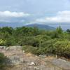
Goat Peak Out-and-Back
0.9 mi 1.5 km • 277' Up 84.39 m Up • 277' Down 84.49 m Down
Eastham…, MA
 Pisgah State Park Ridge Loop
7.9 mi 12.7 km • 767' Up 233.82 m Up • 773' Down 235.67 m Down
Gap Mountain
2.6 mi 4.3 km • 602' Up 183.55 m Up • 602' Down 183.51 m Down
 Troy, NH
 Wapack and Back
43.0 mi 69.1 km • 7,536' Up 2296.92 m Up • 7,536' Down 2296.83 m Down
Ashburnham, MA


0 Comments