Dogs Leashed

Features
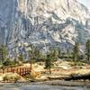
Commonly Backpacked · Fishing · Lake · River/Creek · Swimming · Views · Waterfall · Wildflowers · Wildlife

Wilderness permits are required. The specific quotas depend on the trailhead from which you start.
Need to Know
No campfires are allowed anywhere along this trail.
Description
Note: The trail as drawn does not show all of the small switchbacks. It is probably closer to 2 miles than 1.5 miles.
The Marie Lake Trail branches off the JMT about 50 yards before the point where the JMT crosses Rush Creek. There is a good campsite just across the creek from the start. The trail climbs about 200 feet over the first 0.5 miles, passing some beautiful cascades. At this point, the trail enters a wide, relatively level valley. The creek spreads out here, with several very wide areas that almost qualify as lakes. These will be greatly reduced in the late season. The valley is a beautiful place to camp and fish. You may not be alone, but it is far less crowded than the nearby JMT.
From the valley, the trail begins a fairly steep climb, switch-backing up a sloping granite ridge. The trail was newly reconstructed in the early 1970s and is still mostly in good shape. Unfortunately, it crosses or climbs several north-facing notches, where patches of snow linger late and make it impossible to follow the trail. This can make the run challenging, depending on the amount of snow. In 2019, these patches were still a significant problem in early August. However, if you stay near the top of the sloping ridge, the off-route scramble is not difficult, and there are only a couple of places where you need to use your hands.
As you climb, there are views back down to Waugh Lake and across to the valley that contains Rodgers Lakes. The trail reaches a high point about 50 feet above the lake. From that point, there are superb views of Marie Lake and the surrounding Ritter and Cathedral ranges.
The large Marie Lake sits in almost barren basin beneath the high peaks of the Ritter Range that approach 13,000-feet. Near the outlet, there are scenic, but exposed, campsites. However, in early August 2019, the trail down to the lake was completely covered with snow that continued over the lake itself.
Upper Marie Lake lies in a basin directly beneath the east peak of Mt. Lyell. The upper lake is surrounded by steep cliffs, small glaciers, and fields of permanent snow. It can be reached by running off-trail around the northwest side of Lower Marie Lake and then scrambling due west up the steep 350-foot slope near the far end of the lake.
Contacts
Shared By:
Lee Watts

 Continue with onX Maps
 Continue with Facebook


 Particularly Special Place


 Difficult

 4.5 (2)


0 Comments