
 Continue with onX Maps
 Continue with Facebook


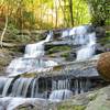
 Particularly Special Place


 Intermediate

 Intermediate
Land Manager: USFS - Cherokee National Forest Office
 Hickory Creek to Panther Creek Falls
10.3 mi 16.5 km • 1,677' Up 511.05 m Up • 1,677' Down 511.09 m Down
 Chatsworth, GA
Trail Running Takeover at Mulberry Gap: Emery Creek Falls
Chatsworth, GA
Trail Running Takeover at Mulberry Gap: Emery Creek Falls
6.1 mi 9.8 km • 665' Up 202.81 m Up • 666' Down 202.94 m Down
Chatsworth, GA
Upper Bald River Wilderness Loop
22.9 mi 36.9 km • 3,876' Up 1181.33 m Up • 3,889' Down 1185.22 m Down
Etowah, TN
 Springer Mountain
8.8 mi 14.1 km • 1,315' Up 400.93 m Up • 1,316' Down 401.1 m Down
Ellijay, GA
 Cruel Jewel 100
100.0 mi 161.0 km • 25,409' Up 7744.6 m Up • 25,408' Down 7744.3 m Down
Blairsv…, GA
H9 Fierce Dragon Out and Back
41.1 mi 66.1 km • 11,021' Up 3359.06 m Up • 11,008' Down 3355.29 m Down


0 Comments