
 Continue with onX Maps
 Continue with Facebook


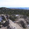
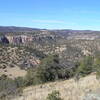
 Particularly Special Place


 Intermediate

 Intermediate
Land Manager: USFS - Gila National Forest Office
 Little Cherry Creek to Signal Peak via CDT
16.2 mi 26.1 km • 3,200' Up 975.24 m Up • 3,199' Down 975.15 m Down
 Whiterocks via North Mesa
12.8 mi 20.5 km • 1,295' Up 394.81 m Up • 1,296' Down 395.07 m Down
Whiterock Adobe Canyon Loop
18.3 mi 29.4 km • 1,901' Up 579.36 m Up • 1,897' Down 578.29 m Down
Dragonfly Loop Trail #720
3.6 mi 5.7 km • 201' Up 61.12 m Up • 200' Down 61.1 m Down
 Arenas…, NM
 Gomez Peak Triple Loop
4.9 mi 8.0 km • 742' Up 226.11 m Up • 745' Down 227.08 m Down
Boston Hill Full Tour
4.2 mi 6.8 km • 330' Up 100.55 m Up • 329' Down 100.15 m Down


0 Comments