
 Continue with onX Maps
 Continue with Facebook


 Particularly Special Place


 Easy/Intermediate
Easy/Intermediate
Easy/Intermediate
 Easy/Intermediate
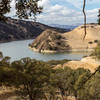
Land Manager: East Bay Regional Park District - Round Valley Preserve
 Mt. Diablo Summit Loop - South
16.0 mi 25.8 km • 3,679' Up 1121.47 m Up • 3,678' Down 1121.12 m Down

 Diablo, CA
 Brazen Racing Diablo Trails Challenge 50k
31.4 mi 50.5 km • 6,147' Up 1873.48 m Up • 6,148' Down 1873.76 m Down
Saranap, CA
 Ridgeline Loop
4.8 mi 7.7 km • 565' Up 172.13 m Up • 545' Down 166.01 m Down
Springhill to Lafayette Ridge to Briones Crest to Sunrise to Buckeye
4.0 mi 6.4 km • 978' Up 298.05 m Up • 976' Down 297.48 m Down
Lafayette, CA
Educational Loop
4.3 mi 6.9 km • 622' Up 189.54 m Up • 621' Down 189.4 m Down
Briones-Alhambra Valley Loop
4.4 mi 7.1 km • 760' Up 231.56 m Up • 761' Down 232.01 m Down


0 Comments