
 Continue with onX Maps
 Continue with Facebook


 Particularly Special Place


 Intermediate
Intermediate
Intermediate
 Intermediate
Land Manager: USFS - Pisgah National Forest, Pisgah Ranger District
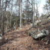
 MST/Powhatan Loop
9.9 mi 16.0 km • 1,274' Up 388.4 m Up • 1,302' Down 396.77 m Down

 Art Loeb Trail
31.1 mi 50.1 km • 7,578' Up 2309.92 m Up • 6,409' Down 1953.61 m Down
 Brevard, NC
 Art Loeb & North Slope Loop
7.4 mi 11.8 km • 1,330' Up 405.5 m Up • 1,329' Down 405.11 m Down
Rough Creek Goodness
7.0 mi 11.3 km • 1,343' Up 409.25 m Up • 1,341' Down 408.61 m Down
John Rock Loop
5.7 mi 9.1 km • 975' Up 297.1 m Up • 970' Down 295.68 m Down
Brevard, NC
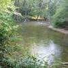
DuPont Waterfall Bonanza
14.1 mi 22.7 km • 1,472' Up 448.73 m Up • 1,503' Down 458.01 m Down


0 Comments