Trail Run Project Logo

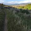
A fun trail, especially early in the year before the grass gets tall.


Your Rating: Rating Rating Rating Rating Rating      Clear Rating
Your Difficulty:
Your Favorites: Add To-Do · Your List
Zoom in to see details
Map Key

1.7

Miles

2.7

KM

76%

Runnable

6,459' 1,969 m

High

5,669' 1,728 m

Low

110' 34 m

Up

817' 249 m

Down

10%

Avg Grade (6°)

30%

Max Grade (17°)

Dogs Unknown

Description

Across from where the Crystal Springs Trail intersects Crystal Summit road there is a short doubletrack road heading east to a campsite about 50 yards from the Crystal Summit road. Take this doubletrack past the campsite where it turns into singletrack. Follow the singletrack downhill. It soon passes through a small meadow and then angles left up a gentle climb until until reaching a barbed wire fence with a gate. Go through the gate, up a short climb to where it tops out, and then its all downhill to the West Fork Trail. There's one creek crossing and a few tight corners.

This trail can be done up from West Fork, but it's a tougher climb. Consequently, almost all traffic is downhill.

Contacts

Shared By:

TJ Budge

Trail Ratings

  4.0 from 1 vote

#33

in Pocatello

#17813

Overall
  4.0 from 1 vote
5 Star
0%
4 Star
100%
3 Star
0%
2 Star
0%
1 Star
0%
Trail Rankings

#33

in Pocatello

#657

in Idaho

#17,813

Overall
2 Views Last Month
200 Since Oct 5, 2017
Intermediate Intermediate

0%
0%
100%
0%
0%
0%

0 Comments

Weather


Current Trail Conditions

Unknown
Add Your Check-In

Check-Ins

none
Welcome

Join the Community

Create your FREE account today!
Already have an account? Login to close this notice.

Get Started