
 Continue with onX Maps
 Continue with Facebook


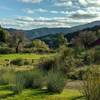
 Particularly Special Place


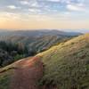
 Intermediate
Intermediate
Intermediate
 Intermediate
Land Manager: Mid-Peninsula Regional Open Space District
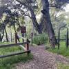
 Quicksilver History Loop
8.0 mi 12.9 km • 1,454' Up 443.32 m Up • 1,456' Down 443.8 m Down

 Almaden…, CA
Rancho San Vicente Loop
Almaden…, CA
Rancho San Vicente Loop
8.4 mi 13.6 km • 672' Up 204.86 m Up • 672' Down 204.74 m Down
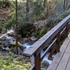
 Waterfall Loop Nature Trail
1.0 mi 1.7 km • 320' Up 97.46 m Up • 318' Down 96.97 m Down
Day Valley, CA
Fremont Older to Steven's Creek Reservoir Loop
7.7 mi 12.4 km • 1,402' Up 427.18 m Up • 1,399' Down 426.42 m Down
Saratoga, CA
Middle Ridge Loop
9.3 mi 14.9 km • 1,546' Up 471.13 m Up • 1,545' Down 470.99 m Down
Morgan…, CA
 Berry Creek Falls Loop
9.7 mi 15.6 km • 1,844' Up 562.19 m Up • 1,835' Down 559.42 m Down
Boulder…, CA


 All Clear


0 Comments