
 Continue with onX Maps
 Continue with Facebook


 Particularly Special Place


 Intermediate
Intermediate
Intermediate
 Intermediate
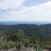
 Kanaka Peak
6.7 mi 10.8 km • 1,561' Up 475.94 m Up • 1,560' Down 475.45 m Down
 Shasta, CA
Boulder Creek Falls (South Shore Drive Access)
Shasta, CA
Boulder Creek Falls (South Shore Drive Access)
5.6 mi 9.0 km • 1,056' Up 321.88 m Up • 1,055' Down 321.69 m Down
Flanagan Trail to Chamise Peak
5.2 mi 8.4 km • 767' Up 233.86 m Up • 767' Down 233.84 m Down
 Central…, CA
 Emerald and Sapphire Lakes
27.1 mi 43.7 km • 3,991' Up 1216.37 m Up • 3,992' Down 1216.67 m Down
Weaverv…, CA


0 Comments