
 Continue with onX Maps
 Continue with Facebook


 Particularly Special Place


 Difficult
Difficult
Difficult
 Difficult
Land Manager: USFS - Shasta & Trinity National Forest Office
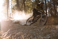
 Flanagan Trail to Chamise Peak
5.2 mi 8.4 km • 767' Up 233.86 m Up • 767' Down 233.84 m Down

 Central…, CA
Boulder Creek Falls (South Shore Drive Access)
Central…, CA
Boulder Creek Falls (South Shore Drive Access)
5.6 mi 9.0 km • 1,056' Up 321.88 m Up • 1,055' Down 321.69 m Down
Kanaka Peak
6.7 mi 10.8 km • 1,561' Up 475.94 m Up • 1,560' Down 475.45 m Down
Shasta, CA
 Four Lakes Loop
17.4 mi 27.9 km • 5,698' Up 1736.74 m Up • 5,697' Down 1736.56 m Down
Lewiston, CA
Granite Lake
9.8 mi 15.8 km • 1,953' Up 595.24 m Up • 1,952' Down 594.97 m Down
Lewiston, CA


0 Comments