
 Continue with onX Maps
 Continue with Facebook


 Particularly Special Place


 Intermediate
Intermediate
Intermediate
 Intermediate
Local Club: Northeast Running Club (NERC)
Land Manager: LMP Lake County Metro Parks
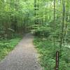
 Holden Arboretum Loop
3.3 mi 5.3 km • 405' Up 123.56 m Up • 405' Down 123.39 m Down

 Kirtland, OH
 Patented EZ 7
7.4 mi 11.9 km • 173' Up 52.85 m Up • 168' Down 51.3 m Down
 North Chagrin Mega Loop
8.0 mi 12.8 km • 483' Up 147.26 m Up • 483' Down 147.12 m Down
Mayfield, OH
 Euclid Creek Reservation All Purpose Trail
4.9 mi 7.9 km • 267' Up 81.28 m Up • 267' Down 81.27 m Down
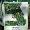
Acacia Park Trail Loop
2.8 mi 4.6 km • 142' Up 43.3 m Up • 152' Down 46.22 m Down
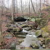
Deer Lick Cave Loop Trail
3.8 mi 6.1 km • 434' Up 132.32 m Up • 439' Down 133.86 m Down


0 Comments