
 Continue with onX Maps
 Continue with Facebook


 Particularly Special Place


 Intermediate
Intermediate
Intermediate
 Intermediate
Land Manager: Ojai Valley Land Conservancy
 Gridley Trail to Nordhoff Peak
14.3 mi 23.1 km • 3,328' Up 1014.42 m Up • 3,327' Down 1014.22 m Down

 Ojai, CA
 Gene Marshall Out and Back
14.3 mi 22.9 km • 2,669' Up 813.53 m Up • 2,669' Down 813.41 m Down
Meiners…, CA
Buena Vista Loop
3.2 mi 5.2 km • 889' Up 270.9 m Up • 901' Down 274.53 m Down
 Montecito Connections Loop
5.4 mi 8.7 km • 1,447' Up 441.08 m Up • 1,449' Down 441.72 m Down
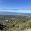
Montecito Peak
7.0 mi 11.3 km • 2,352' Up 716.99 m Up • 2,352' Down 716.91 m Down
Happy Camp Canyon Trail Loop
10.9 mi 17.6 km • 1,253' Up 381.86 m Up • 1,253' Down 381.92 m Down
Moorpark, CA


0 Comments