
 Continue with onX Maps
 Continue with Facebook


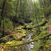
 Particularly Special Place


 Difficult

 Difficult
Land Manager: California State Parks - Big Basin Redwoods State Park
 Skyline to the Sea Trail
25.4 mi 40.9 km • 1,910' Up 582.14 m Up • 4,515' Down 1376.15 m Down
 Saratoga, CA
 Vista Verde Skyline Run - 50K
31.3 mi 50.4 km • 4,688' Up 1429.02 m Up • 4,690' Down 1429.58 m Down
La Honda, CA
 Vista Verde Skyline Run - Marathon
26.8 mi 43.1 km • 4,268' Up 1300.86 m Up • 4,269' Down 1301.07 m Down
La Honda, CA
Black Mountain loop via Stevens Creek
5.9 mi 9.5 km • 1,209' Up 368.43 m Up • 1,208' Down 368.2 m Down
La Honda, CA
Henry Cowell Park
8.4 mi 13.6 km • 1,614' Up 491.82 m Up • 1,614' Down 492.03 m Down
Felton, CA
Alambique Loop Trail
1.8 mi 2.9 km • 343' Up 104.68 m Up • 341' Down 104.07 m Down
Woodside, CA


0 Comments