
 Continue with onX Maps
 Continue with Facebook


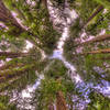
 Particularly Special Place


 Difficult
Difficult
Difficult
 Difficult
Land Manager: California State Parks - Tamalpais State Park
 Panoramic Loop
4.5 mi 7.3 km • 943' Up 287.4 m Up • 941' Down 286.79 m Down

 Tamalpa…, CA
Mt. Tam Wild Boar Half Marathon
Tamalpa…, CA
Mt. Tam Wild Boar Half Marathon
11.4 mi 18.4 km • 1,446' Up 440.65 m Up • 1,441' Down 439.26 m Down
Mill Va…, CA
 Muir Beach Loop
5.8 mi 9.4 km • 1,164' Up 354.88 m Up • 1,164' Down 354.8 m Down
Tamalpa…, CA
Steep Ravine - Matt Davis Loop
7.1 mi 11.4 km • 1,556' Up 474.2 m Up • 1,589' Down 484.37 m Down
Bolinas, CA
 Golden Gate Headlands 10K
6.2 mi 9.9 km • 1,165' Up 355.09 m Up • 1,162' Down 354.07 m Down
Marin City, CA
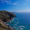
Golden Gate Bridge Overlook Out-and-Back
5.3 mi 8.5 km • 1,000' Up 304.86 m Up • 999' Down 304.44 m Down
Sausalito, CA


0 Comments