
 Continue with onX Maps
 Continue with Facebook


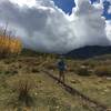
 Particularly Special Place


 Easy
Easy
Easy
Easy
 Easy
Easy
Land Manager: BLM Utah - Monticello Field Office
 Fish and Owl Canyon Loop Route
17.1 mi 27.5 km • 1,992' Up 607.16 m Up • 1,995' Down 608.12 m Down

 Blanding, UT
 Kane Gulch to Junction & Turkey Pen Ruins
9.4 mi 15.1 km • 1,249' Up 380.68 m Up • 1,249' Down 380.84 m Down
Blanding, UT
 Moon House Ruins
4.6 mi 7.4 km • 497' Up 151.59 m Up • 497' Down 151.56 m Down
Blanding, UT
Hammond Canyon to Posey Canyon
10.5 mi 16.9 km • 2,482' Up 756.51 m Up • 2,186' Down 666.3 m Down
Blanding, UT
The Narrows of Grand Gulch
4.2 mi 6.7 km • 372' Up 113.4 m Up • 372' Down 113.51 m Down
Blanding, UT
Robertson Pasture Trail (20)
14.5 mi 23.3 km • 2,712' Up 826.49 m Up • 2,711' Down 826.46 m Down
Monticello, UT


0 Comments