
 Continue with onX Maps
 Continue with Facebook


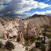
 Particularly Special Place


 Intermediate

 Intermediate
Land Manager: USFS - Santa Fe National Forest Office
 Los Alamos County Low Point to High Point
38.0 mi 61.1 km • 9,338' Up 2846.1 m Up • 7,914' Down 2412.07 m Down
 Shrine of the Stone Lions AKA Yapashi Pueblo Ruins
12.8 mi 20.7 km • 2,548' Up 776.56 m Up • 2,548' Down 776.52 m Down
 White Rock, NM
 Falls Trail
2.9 mi 4.6 km • 360' Up 109.82 m Up • 360' Down 109.85 m Down
 Slot Canyon Trail Out and Back
3.0 mi 4.8 km • 815' Up 248.3 m Up • 814' Down 248.14 m Down
Santo D…, NM
McCauley Hot Springs Out and Back
3.6 mi 5.8 km • 722' Up 220.2 m Up • 722' Down 220.14 m Down
Jemez P…, NM
Chamisa Trail Loop via Saddleback and Windsor
9.9 mi 16.0 km • 1,908' Up 581.68 m Up • 1,897' Down 578.25 m Down
Santa Fe, NM


0 Comments