
 Continue with onX Maps
 Continue with Facebook


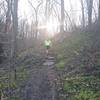
 Particularly Special Place


 Easy
Easy

 Easy
Easy
Land Manager: City of Pittsburgh, PA - Parks
 Rachel Carson Trail Challenge
39.1 mi 62.9 km • 6,014' Up 1833.08 m Up • 5,831' Down 1777.15 m Down
 Ol Renziehausen
0.9 mi 1.5 km • 149' Up 45.53 m Up • 152' Down 46.39 m Down
 Twin Hills Park Loop
0.7 mi 1.2 km • 93' Up 28.4 m Up • 100' Down 30.45 m Down
Dormont, PA
Hell Hath No Hurry Course (modified)
7.2 mi 11.5 km • 763' Up 232.53 m Up • 762' Down 232.34 m Down
Boyce Park East and West Loop
7.9 mi 12.8 km • 657' Up 200.39 m Up • 668' Down 203.54 m Down
Cool Spirit Loop
5.7 mi 9.1 km • 525' Up 160.02 m Up • 525' Down 160.05 m Down


0 Comments