Dogs Leashed

Features
Views · Wildflowers · Wildlife

The Windy Hill Open Space Preserve is open 30 minutes before sunrise to 30 minutes after sunset throughout the year.
Overview
The Hamms Gulch-
Spring Ridge Trail Loop provides access to the open areas of the preserve along Skyline Drive. The trail starts off Portola Valley Road and follows
Spring Ridge Trail until it gets to
Hamms Gulch Trail where the trail enters the woods and begins to climb up the gulch. Wildflowers can be seen in the spring sitting alongside the trail as it ascends to the hilltop. The trail moves through the woods via a series of steep climbs and switchbacks until it finally reaches the
Lost Trail, where this route takes you to the right to a small parking lot sits off Skyline Drive. From here the
Anniversary Trail leads out to the summit of Windy Hill.
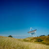
At the summit of Windy Hill, sweeping views of the San Francisco Bay, South Bay area, and other preserves stretch out before you to the east. To the west, the Santa Monica Mountains provide a reprieve from Silicon Valley. After enjoying the view, the trail meets up with the
Spring Ridge Trail. From here, the trail cuts to the right and descends steeply back into the lower parts of the preserve through open fields. Views are great through this section of the trail as it is open. Wildflowers can be seen on either side of the trail and views back up the hill offer views of where you were moments before. The Stanford Dish, Hoover Tower, and other landmarks can be seen as the trail descends rapidly. Deer, rabbits, various species of birds, and other animals can be seen feeding along the trail in the evenings.
Once it passes the junction with the
Meadow Trail, the trail drops into the woods until it arrives back at the bottom of the hill where you traveled to reach
Hamms Gulch Trail. From here, it's an easy stroll back to you car.
Need to Know
The name Windy Hill is appropriate for this area as the wind can blow along the hill tops, causing the temperature to be cooler than when you started. Be sure to bring a long sleeve shirt or jacket to help shield you from the wind. Bring plenty of water for your run as there is no potable water in the preserve. There are benches along the trails, often at scenic viewpoints, which offer opportunities for rest and breaks.
Runner Notes
The trail is strewn with rocks and roots, making footing tricky. There are also portions of the trails that have been washed out due to erosion making the trail uneven. Sections of the
Spring Ridge Trail have been heavily used by equestrians and mountain bikers, and when wet the trail gets turned up.
Description
The route leaves the parking lot in Portola Valley and breaks off to the left as it follows the
Spring Ridge Trail. The trail begins to gently climb uphill as private property sits off on the lefthand side of the trail and a pond sits on the right hand side, although it is mostly obscured by trees. The dirt trail is wide and used by horseback riders, mountain bikers, and other runners. This causes the trail to suffer from erosion, and it can be torn up if it has been wet recently. Wildflowers can be seen on the side of the trail in the spring as the trail rolls gradually uphill. The trail continues straight ahead until the
Spring Ridge Trail breaks off to the right and climbs steeply uphill. Go straight through the intersection and follow the trail until it crosses the private road roughly .2 miles ahead.
Cross the road and continue straight ahead as the
Meadow Trail breaks off to the left and leads down to the park boundary. Things can be confusing in this section as the
Meadow Trail breaks off to the left and then breaks to the right again shortly after as it ascends into the meadow. Our path breaks off to the left and begins to descend toward the creek. The trail enters into the woods as the path drops to the creek as it exits the park briefly. If there is water running through the area, it can be easily overcome via a rock hop. While the
Eagle Trail crosses the creek again to the left, the
Hamms Gulch Trail begins to climb steeply uphill as it re-enters the preserve.
The
Hamms Gulch Trail climbs uphill toward Skyline Boulevard where more expansive views await. The trail works its way through the woods, which provide shade at all hours of the day. At roughly 1.9 miles, there is a bench where you can take a break and enjoy the views of the hills across the gulch. At 2.0 miles, the trail levels out for a little bit, offering a needed respite from the climb as it follows the ridge line. After a short distance, the trail starts climbing a series of switchbacks as views of Windy Hill can be seen, although obscured off to the right. At 3.3 miles, there is a side trail off to the right that leads to a small outcrop of rocks that offers views of the Stanford Dish area and the bay beyond.
At 3.6 miles, the trail intersects with the
Lost Trail and our path cuts off to the right as it levels out and works its way 1.1 to the
Spring Ridge Trail. Entering a shrub lined corridor, the path follows the road for a little bit before meeting up with the
Anniversary Trail at roughly 4.3 miles at a parking lot alongside Skyline Blvd. The
Anniversary Trail wraps around the hillside as it makes its way to the summit. Great views to the east stretch out on the right hand side of the trail. A small trail goes off to the left that leads to the true Windy Hill summit. Great views of the bay area, the Windy Hill Preserve, and Santa Monica Mountains spread out before you. After returning to the
Anniversary Trail, the route drops down to another parking lot along the road at 5 miles where the
Spring Ridge Trail begins.
The
Spring Ridge Trail begins to drop steeply into the preserve on a wide, doubletrack dirt trail. The trail drops steeply, passing a spring suitable for horses but not humans, as it winds its way through the open fields. Wildlife can be seen feeding alongside the trail in the evenings. In steeper sections, the trail changes from dirt to gravel to help with erosion. Trekking poles help navigate the steep grades by taking stress off the knees. At 6.6 miles, the
Meadow Trail breaks off to the right as the trail drops into the woods and the descent becomes less steep. A small connector trail to the lower sections of the
Meadow Trail cuts off to the right at 7 miles. The trail finally levels out and cuts back to the right, following the lower part of the
Spring Ridge Trail that you traveled on earlier. After about .6 miles, you are back at the parking lot and your car.
Flora & Fauna
Deer, rabbits, coyotes and various species of birds can be seen in the woods. Mountain Lions have been reported in the upper parts of the preserve, so be on the lookout in the mornings and in the evenings.Rattlesnakes have been reported in the area as well, so be on the lookout on hot summer days.
Various wildflowers can be seen in the open meadows and fields that line the trail in the springtime. The nature of the woods change as the trail climbs, giving you opportunities to see various species and ecosystems.
Contacts
Shared By:
David Hitchcock

 Continue with onX Maps
 Continue with Facebook


 Particularly Special Place


 Intermediate/Difficult

 Stanford Dish: Ranch Road via Piers Gate

 Wunderlich Loop
 Black Mountain via Black Mountain Trail
 Los Alt…, CA
 Vista Verde Skyline Run - Marathon


0 Comments