
 Continue with onX Maps
 Continue with Facebook


 Particularly Special Place


 Intermediate

 Intermediate
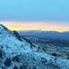
 Card Canyon Loop
7.3 mi 11.7 km • 2,374' Up 723.55 m Up • 2,382' Down 726.06 m Down
 North L…, UT
 Old Jardine Juniper from Wood Camp
10.2 mi 16.4 km • 2,119' Up 645.75 m Up • 2,118' Down 645.49 m Down
Hyde Park, UT
Green Canyon
9.5 mi 15.3 km • 1,124' Up 342.68 m Up • 1,124' Down 342.63 m Down
North L…, UT
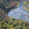
 Logan River Trail
7.4 mi 11.9 km • 561' Up 171.13 m Up • 561' Down 171.02 m Down
Mount Naomi
6.5 mi 10.5 km • 1,850' Up 563.83 m Up • 1,850' Down 563.84 m Down
Richmond, UT
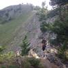
 Wellsville Ridge
11.4 mi 18.3 km • 4,422' Up 1347.87 m Up • 4,407' Down 1343.34 m Down


0 Comments