
 Continue with onX Maps
 Continue with Facebook


 Particularly Special Place


 Intermediate
Intermediate
Intermediate
 Intermediate
Land Manager: NPS - Yosemite
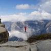
 Dewey Point
8.0 mi 12.8 km • 835' Up 254.57 m Up • 834' Down 254.3 m Down

 Yosemit…, CA
 Mono Meadow Sampler
3.6 mi 5.9 km • 449' Up 136.93 m Up • 451' Down 137.35 m Down
Taft Point
2.3 mi 3.7 km • 276' Up 84.09 m Up • 276' Down 84.13 m Down
Yosemit…, CA
Taft Point to Sentinel Dome Loop
5.5 mi 8.9 km • 1,051' Up 320.3 m Up • 1,043' Down 317.87 m Down
Yosemit…, CA
 Tamarack and Cascade Creek Tour
8.0 mi 12.8 km • 1,418' Up 432.19 m Up • 1,418' Down 432.12 m Down
Eagle Peak and Yosemite Falls Extravaganza
11.0 mi 17.8 km • 3,840' Up 1170.31 m Up • 3,840' Down 1170.32 m Down
Yosemit…, CA


0 Comments