
 Continue with onX Maps
 Continue with Facebook


 Particularly Special Place


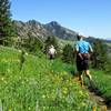
 Intermediate


 Intermediate
Land Manager: Broomfield City and County
 Spring Brook / Goshawk Double Loop
8.3 mi 13.3 km • 1,065' Up 324.5 m Up • 1,065' Down 324.47 m Down
Superior, CO
Shanahan Ridge
3.9 mi 6.3 km • 831' Up 253.22 m Up • 831' Down 253.4 m Down
 Walker Ranch, Ethel Harrold, and Canyon Falls
3.5 mi 5.7 km • 583' Up 177.57 m Up • 583' Down 177.57 m Down
Coal Creek, CO
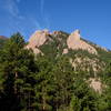
 Royal Arch Out and Back
3.4 mi 5.5 km • 1,252' Up 381.69 m Up • 1,251' Down 381.29 m Down
Boulder, CO
Green Mountain via Ranger/Saddle Rock Loop
4.9 mi 7.9 km • 2,304' Up 702.34 m Up • 2,276' Down 693.72 m Down
Boulder, CO
Green Mountain West Ridge
3.9 mi 6.3 km • 633' Up 193.08 m Up • 634' Down 193.23 m Down


 All Clear


0 Comments