
 Continue with onX Maps
 Continue with Facebook


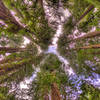
 Particularly Special Place


 Easy/Intermediate
Easy/Intermediate
Easy/Intermediate
 Easy/Intermediate
Land Manager: Marin Municipal Water District
 Mt. Tam Wild Boar 10K
6.1 mi 9.8 km • 885' Up 269.65 m Up • 858' Down 261.67 m Down
 Mill Va…, CA
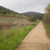
 Hillside Loop
2.5 mi 3.9 km • 255' Up 77.77 m Up • 255' Down 77.75 m Down
 Tamalpa…, CA
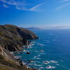
 Tamalpa Headlands 50k
32.2 mi 51.8 km • 6,519' Up 1986.94 m Up • 6,521' Down 1987.5 m Down
Tamalpa…, CA
 Muir Beach Loop
5.8 mi 9.4 km • 1,164' Up 354.88 m Up • 1,164' Down 354.8 m Down
Tamalpa…, CA
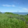
Tennessee Valley Lollipop
4.1 mi 6.7 km • 761' Up 231.89 m Up • 761' Down 232 m Down
Tamalpa…, CA
China Camp Challenge Half Marathon Course
13.0 mi 21.0 km • 1,740' Up 530.21 m Up • 1,738' Down 529.65 m Down
Santa V…, CA


0 Comments