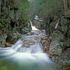
Land Manager: USFS - Saco Ranger Station
 Diana's Bath Out and Back
1.1 mi 1.8 km • 83' Up 25.41 m Up • 85' Down 25.82 m Down


 North C…, NH
 Pemi Loop
30.0 mi 48.2 km • 7,408' Up 2257.85 m Up • 7,402' Down 2256.07 m Down


 Lincoln, NH
 Four Summits Loop (Tom, Field, Willey, Avalon)
9.3 mi 14.9 km • 3,325' Up 1013.38 m Up • 3,325' Down 1013.39 m Down


 Pinkham…, NH
 Mount Osceola Out and Back
5.9 mi 9.4 km • 1,952' Up 595.09 m Up • 1,952' Down 595.07 m Down


 Watervi…, NH
 Ledge to Pine Mountain Loop
3.5 mi 5.7 km • 810' Up 246.98 m Up • 808' Down 246.22 m Down


 Gorham, NH
 Cannon-Lonesome Loop
5.8 mi 9.3 km • 2,398' Up 730.77 m Up • 2,398' Down 730.82 m Down


 Lincoln, NH


0 Comments