Trail Run Project Logo

Short, rocky trail.


Your Rating: Rating Rating Rating Rating Rating      Clear Rating
Your Difficulty:
Your Favorites: Add To-Do · Your List
Zoom in to see details
Map Key

0.8

Miles

1.2

KM

99%

Runnable

481' 147 m

High

446' 136 m

Low

49' 15 m

Up

28' 8 m

Down

2%

Avg Grade (1°)

5%

Max Grade (3°)

Dogs Leashed

Features River/Creek

Description

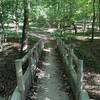
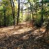
This trail can connect the main Cherokee Park Trails to the Seneca Park trails, often used by mountain bikers, or simply add more length to a run in Cherokee itself. It involves some fun rocky sections and a short road section.

After exiting the singletrack at Park Boundary Rd, turn right onto Beargrass Rd and follow the creek, then head into the wooded area to run along some small cliffs. The trail exits at a parking lot; do a U-turn and follow the road back to Alta Vista Rd where the trail picks up for a short, technical section along another cliff. It then rejoins the main Cherokee Park MTB/multi-use trails.

Contacts

Shared By:

Samuel Hartman

Trail Ratings

  3.0 from 1 vote

#38562

Overall
  3.0 from 1 vote
5 Star
0%
4 Star
0%
3 Star
100%
2 Star
0%
1 Star
0%
Trail Rankings

#384

in Kentucky

#38,562

Overall
2 Views Last Month
13 Since Sep 8, 2020
Intermediate/Difficult Intermediate/Difficult

0%
0%
0%
100%
0%
0%

0 Comments

Weather


Current Trail Conditions

Unknown
Add Your Check-In

Check-Ins

none
Welcome

Join the Community! It's FREE

Already have an account? Login to close this notice.