
Land Manager: USFS - Gifford Pinchot
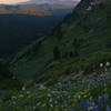
 Snowgrass Flats Loop
15.0 mi 24.1 km • 2,978' Up 907.84 m Up • 2,988' Down 910.6 m Down
 Morton, WA
 Packwood Lake
8.5 mi 13.7 km • 681' Up 207.53 m Up • 680' Down 207.36 m Down
 Morton, WA
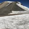
 Mount Adams South Climb (Lunch Counter Approach)
11.8 mi 18.9 km • 6,687' Up 2038.12 m Up • 6,686' Down 2037.97 m Down
White S…, WA

 Continue with onX Maps
 Continue with Facebook


 Particularly Special Place


0 Comments