
 Continue with onX Maps
 Continue with Facebook


 Particularly Special Place


 Intermediate
Intermediate
Intermediate
 Intermediate
Land Manager: Cal Fire - Demonstration State Forests
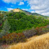
 Mount Umunhum Summit and Back
8.3 mi 13.3 km • 1,195' Up 364.28 m Up • 1,195' Down 364.29 m Down

 Almaden…, CA
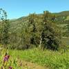
Quicksilver - McAbee Loop CCW
Almaden…, CA
Quicksilver - McAbee Loop CCW
4.5 mi 7.3 km • 728' Up 221.89 m Up • 738' Down 225.02 m Down
Highland Loop
4.8 mi 7.8 km • 695' Up 211.92 m Up • 670' Down 204.18 m Down
Coyote Lake and Ridge Hike
6.8 mi 11.0 km • 797' Up 242.86 m Up • 797' Down 242.91 m Down
Fremont Older to Steven's Creek Reservoir Loop
7.7 mi 12.4 km • 1,402' Up 427.18 m Up • 1,399' Down 426.42 m Down
Saratoga, CA
Fremont Older Open Space Loop
5.6 mi 9.0 km • 928' Up 282.99 m Up • 928' Down 282.85 m Down


0 Comments