
 Continue with onX Maps
 Continue with Facebook


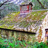
 Particularly Special Place


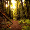
 Intermediate


 Intermediate
Land Manager: City of San Carlos CA - Parks and Recreation
 BayTrailrunners Whiskey Hill Redwood Run - 50k
30.1 mi 48.4 km • 4,680' Up 1426.34 m Up • 4,679' Down 1426.28 m Down
Woodside, CA
 BayTrailrunners Whiskey Hill Redwood Run - Marathon
25.6 mi 41.1 km • 4,096' Up 1248.51 m Up • 4,078' Down 1243.02 m Down
Woodside, CA
 Alambique Loop Trail
1.8 mi 2.9 km • 343' Up 104.68 m Up • 341' Down 104.07 m Down
Woodside, CA
Grabtown Gulch - Borden Hatch Mill Loop Trail
4.8 mi 7.7 km • 1,240' Up 378.07 m Up • 1,238' Down 377.2 m Down
Woodside, CA
 Arastradero Short Loop
3.4 mi 5.5 km • 421' Up 128.26 m Up • 417' Down 127.03 m Down
Remote Rancho Corral de Tierra
10.2 mi 16.4 km • 1,868' Up 569.36 m Up • 1,906' Down 580.84 m Down


0 Comments