
 Continue with onX Maps
 Continue with Facebook


 Particularly Special Place


 Intermediate
Intermediate
Intermediate
 Intermediate
Land Manager: USFS - Pisgah National Forest, Pisgah Ranger District
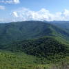
 John Rock Loop
5.7 mi 9.1 km • 975' Up 297.1 m Up • 970' Down 295.68 m Down

 Brevard, NC
Bracken Preserve Loop
Brevard, NC
Bracken Preserve Loop
4.6 mi 7.5 km • 767' Up 233.86 m Up • 766' Down 233.62 m Down
Brevard, NC
 Hap Nin Half-ish Marathon (Shining Rock Loop)
13.3 mi 21.4 km • 3,106' Up 946.86 m Up • 3,101' Down 945.1 m Down
 DuPont Waterfall Bonanza
14.1 mi 22.7 km • 1,472' Up 448.73 m Up • 1,503' Down 458.01 m Down
Bearpen Gap Waterfall
3.2 mi 5.2 km • 626' Up 190.93 m Up • 627' Down 191.04 m Down
Cold Mountain Out-and-Back
10.4 mi 16.8 km • 2,724' Up 830.26 m Up • 2,724' Down 830.18 m Down


0 Comments